NA-C603 C-Card Format Hawaiian Islands
Model: NA-C603 Brand: C-Map
Every single chart is included for the area covered (at all scales), as well as all the new Value-Added Data (coastal mapping, aerial photos, etc.). MegaWide cartridges can only be used on MAX compatible plotters. C-Card Compatability Check with C-Map for list of compatible models Cobra Interphase Koden Navman Northstar Simrad Si-Tex Standard Horizon NA-C603 Hawaiian Islands NT+ Cartography NT+ electronic charts feature much wider coverage areas at substantially lower prices. « less
Product Specification
-
Universal Product Identifiers
Part Numbers: 19571, CMANAC603CCARD, CW-19571, NA-C603C-CARD
Related Products
-
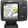
408470-1 581i Di Combo Fishfinder
-
Package(c127 with aus, NZ, S. America, Asia Chart, 4KW 18 Inch Digital Radome & Radar Cable)
-
Package(C140W, DSM300G Sounder, 4KW 18 Inch Digital Radome & Radar Cable)
-
Package(e97 with aus, NZ, S. America, Asia Chart, 4KW 18 Inch Digital Radome & Radar Cable)
-
Max EN-M604 W34 Russian Lakes-MAX
-
010-C1020-10 Bluechart G2 HPC024RAustralia & New Zealand Data
-
Marine RADIO-FIX VHF Class-D DSC Black (143-MRF80BD)
-
Standard - Gx5000S - Quantum, Hailer, Rem CON, BLUETOOTH, Blk
-
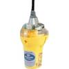
Smartfind Plus G5 GPS EPIRB Automatic Cat I
-
Fishfinder 597ci HD Combo
-
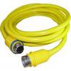
30 Amp 75' Cord Set - Yellow - 125V
-
10ft USB 2.0 A Male to A Female Extension 28/24AWG Cable (Gold Plated)