Marine Navigation: Celestial and electronic [Book]
Product Specification
-
Authors: Richard R. HobbsPages: 322Format: hardbackPublication Date: December 1, 1974Key Terms: celestial navigation, Nautical Almanac, celestial horizon, celestial sphere, sky wave, Polaris, Canopus, U.S. Navy, latitude, longitude, fathometer, Loran, celestial equator, Decca, Corr, NAVSAT, Greenwich meridian, interpolation, slave station, Starfinder
-
Universal Product Identifiers
ISBN: 0870213652GTIN: 09780870213656
Related Products
-
DVD - Mastering Marine Radar #N8985DVD
-
AS-M001 SD Card Format Gulf of Thailand - Yellow Sea
-
T70040 E95 Multifunction Display w/US Coastal Charts
-
M504 Black VHF Radio with Hailer M504A 61
-
MRF55B VHF Radio Submersible Black
-
2680 Nauticast Class B AIS System W/ANTENNAS & Cables
-
1550 Knife Rigging Standard S/S
-
25ft 24AWG Cat6 550mhz UTP Ethernet Bare Copper Network Cable - Green
-
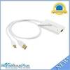
LD 5969 Mini DisplayPort to HDMI Video Adapter Cable (White)
-
MP 134 24AWG Cat5e 350MHz UTP Ethernet Cable, 7 Foot - Blue
-
9282.3 PT Pad Remote Kit for RCL50-100
-
Product FCF0016000GS Air Conditioner 115V FCF16000