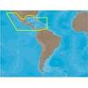
MapSource BlueChart - New York - New Jersey - Maps
Model: Brand: Garmin
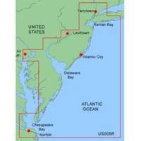
MapSource BlueChart is Garmin's exclusive marine cartography and was developed to provide you with mapping flexibility and options you've never had before. This line of cartography products is designed to provide interactive viewing of detailed nautical chart data, thereby providing navigators with innovative object-oriented cartography. These detailed electronic nautical charts look just like paper charts when displayed on your Garmin chartplotter. Features include shading between depth contours, spot soundings, navaids, port plans, wrecks, obstructions, inter-tidal zones, and more. BlueChart offers much larger coverage areas for half the price. MapSource BlueChart New York - New Jersey offers coverage of Raritan Bay to Norfolk, includes Tarrytown to Fire Island Inlet, entire New Jersey coastline, Delaware Bay, Delaware River, C&D Canal, Chincoteague Bay and Newport News. « less
Product Specification
-
General
Product Type: MapsDistribution Media: microSD Memory CardFirst Seen On Google Shopping: January 2006 -
Compatibility Information
Designed For: Garmin eTrex Legend Cx, Vista Cx Garmin GPSMAP 60CSx, 60Cx, 76CSx, 76Cx -
Universal Product Identifiers
Part Numbers: 010-C0340-00, New York - New JerseyGTIN: 00753759055691
Related Products
-
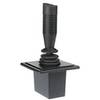
E12136 Autopilot Joy Stick
-
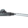
1441 HANDI- Mate O.B. Handle w/Swivel
-
SC103 Radar Pole Mount 6' Kit for Garmin/Furuno Domes
-
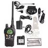
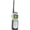
Nautico 3 VHF Marine Emergency Radio Rechargeable
-
NA-M027 SD Card Format Central America & Car
-
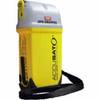
MT410G AccuSat 406 PocketPro PLB w/Integral GPS
-
Atlantis 250 VHF Handheld UNI50051
-
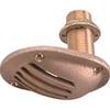
0065DP4PLB 1/2 Scoop Thru Hull w/Nut
-
2206 Terminal Feed Thru 3/8 L Red
-
Butt CONNECTOR, Single CRIMP, Nylon Insulated Yellow, 12-10, 100 Pack
-
(1) 100 Amp 125/250 Volt Connector to (2) 50 Amp
-
2ft 24AWG Cat6 550mhz UTP Ethernet Bare Copper Network Cable - White