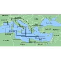
MapSource BlueChart - Italy, Adriatic Sea - Maps
Model: Brand: Garmin
MapSource BlueChart is Garmin's exclusive marine cartography and was developed to provide you with mapping flexibility and options you've never had before. This line of cartography products is designed to provide interactive viewing of detailed nautical chart data, thereby providing navigators with innovative object-oriented cartography. These detailed electronic nautical charts look just like paper charts when displayed on your Garmin chartplotter. Features include shading between depth contours, spot soundings, navaids, port plans, wrecks, obstructions, inter-tidal zones, and more. BlueChart offers much larger coverage areas for half the price. MapSource BlueChart Italy, Adriatic Sea includes all of the Adriatic Sea and extends south to Siracusa, Sicilia and Gulf of Arcadia, Greece. Includes detailed coverage of Lago Maggiore, Lago d'Iseo, and Lago d'Garda in Italy. « less
Product Specification
-
General
Product Type: MapsDistribution Media: microSD Memory CardFirst Seen On Google Shopping: January 2006 -
Compatibility Information
Designed For: Garmin eTrex Legend Cx, Vista Cx Garmin GPSMAP 60CSx, 60Cx, 76CSx, 76Cx -
Universal Product Identifiers
Part Numbers: 010-C0389-00, Italy, Adriatic Sea
Related Products
-
PAPR03; Region 3 Paper Chart Kit
-
343720122 3720 Series Multivolt White 16 9-31v
-
4263541 Repl. Cigarette/Chart Lighter
-
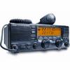
MID-NAUTICO3VP Marine Radio Nautico 3VP
-
A46053 - Flush Mount Kit, Ray 49/55/218, Rear
-
America Inc. M710-21 SSB
-
SP36-2 Autopilot Flux Gate Compass No Drive
-
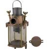
049300799C Transparent Cylinder F/0493007Plb
-
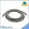
20ft 24AWG Cat6 550mhz UTP Ethernet Bare Copper Network Cable - Gray
-
010-10548-00 A/V Cable
-
Marine Products Plug Wire Set, Mercruiser V-8, 9-28001
-
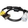
010-11095-00 NMEA 2K Female Connector