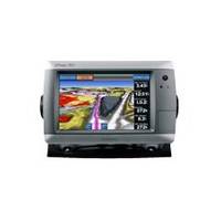
GPSMAP 740 - Marine Chartplotter - 7" color - 800 x 480 - widescreen
Model: 740 Brand: Garmin
GPSMAP 740 is a stand-alone touchscreen chartplotter that brings a high level of functionality to your vessel. Featuring a brilliant 7-inch display, GPSMAP 740 puts all the information you need right at your fingertips. GPSMAP 740 accepts radar input and offers full NMEA 2000 connectivity for greater convenience when adding extra sensors. « less
Product Specification
-
General
Product Type: ChartplotterRecommended Use: MarineCard Reader: SD Memory CardInterface: NMEA 0183, NMEA 2000Functions & Services: Tide TabIncluded Software: Garmin Worldwide Marine BasemapCompatible Software: BlueChart g2 VisionAntenna: Built-inFeatures: Optional external GPS antenna connection, alarm, 2D / 3D map perspective, XM weather support, automatic routing, hunt/fish calendarFirst Seen On Google Shopping: May 2010 -
Display
Type: LCD - color - touch screenDiagonal Size: 7" - widescreenResolution: 800 x 480Features: Adjustable brightness -
Navigation
Waypoints: 3000Tracks: 50Tracklog Points: 20000Routes: 100Trip Computer: Sun/moon positions -
Miscellaneous
Protection: WaterproofWaterproof Standard: IPX7Included Accessories: Protective cover, power/data cable, flush mount -
Dimensions & Weight
Width: 8.8 inDepth: 3.1 inHeight: 5.6 inWeight: 2.4 lbs -
Universal Product Identifiers
Part Numbers: 010-00835-02, 740GTIN: 00753759099909
Related Products
-
CH250BB/88/340 88 kHz Black Box Searchlight Sonar System. Includes 400mm Travel Hoist and Operates at 24 & 32VDC
-
MDS-10-4 Radar Sensor 4KW 4 Array 1/8-48 NM
-
CF/1XG Gold All USA & Northern Bahamas on CF
-
Inc MSD/652P Map, Lake Huron
-
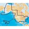
BlueChart g2 Vision - Puget Sound to Port Hardy - Maps
-
010-C0732-20 Bluechart G2 HXUS031RSouthwest Caribbean microSD
-
Cat6a Ethernet Cable | 15ft | Blue | Network | 10 Gigabit
-
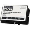
ZDIGAISNET AISnet AIS Base Station
-
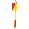
202018 Man Overboard Pole
-
Phone Cable, RJ12 (6p6c), Reverse - 25ft for voice
-
Marine Products Terminal, Spark Plug Wire 9-28122
-
1ft 24AWG Cat5e 350MHz UTP Bare Copper Ethernet Network Cable - Green