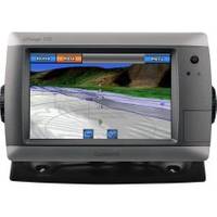
GPSMAP 720 - Marine Chartplotter - 7" color - 800 x 480 - widescreen
Model: 720 Brand: Garmin
GPSMAP 720 is a stand-alone touchscreen chartplotter that brings a new level of functionality to your vessel. Featuring a brilliant 7-inch display, GPSMAP 720 puts all the information you need right at your fingertips. In addition, GPSMAP 720 accepts radar input and offers full NMEA 2000 connectivity for greater convenience when adding extra sensors. « less
Product Specification
-
General
Product Type: ChartplotterRecommended Use: MarineCard Reader: SD Memory CardInterface: NMEA 0183, NMEA 2000Functions & Services: Tide TabCompatible Software: BlueChart g2 VisionAntenna: Built-inFeatures: Alarm, XM Satellite Radio support, XM weather supportFirst Seen On Google Shopping: March 2010 -
Display
Type: LCD - color - touch screenDiagonal Size: 7" - widescreenResolution: 800 x 480 -
Navigation
Waypoints: 3000Tracks: 50Tracklog Points: 20000Routes: 100Trip Computer: Sun/moon positions -
Connections
Interfaces: Garmin Marine Network -
Miscellaneous
Waterproof Standard: IPX7 -
Dimensions & Weight
Width: 8.8 inDepth: 3.1 inHeight: 5.6 inWeight: 2.4 lbs -
Universal Product Identifiers
Part Numbers: 010-00835-00, 720GTIN: 00753759099886
Related Products
-
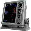
T-941 4KW 36NM Radar 25" Radome 10M Cable
-
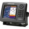
000-10515-001 HDS-5 Gen2 Lake Insight 83200khz Marine Electronics
-
International Radar Mounting Platform Small 975-1111
-
Marine ILIM4040 Hobart LED Reading Chart Marine Light
-
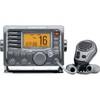
m504a-63 Submersible Plus Class D DSC VHF Marine Radio Gray
-
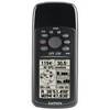
GPS 72H - Marine, hiking GPS receiver - Monochrome - 120 x 160
-
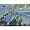
000-10041-001 Nautic Insight HD US Coastal East
-
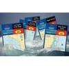
Waterproof Chart Kit - Cape Cod to Cape Ann, Mass #WPB0240
-
Bronze Seacock, 1 1/4 Inch Adapter, Straight 0835007PLB
-
75ft 24AWG Cat5e 350MHz UTP Bare Copper Ethernet Network Cable - Purple
-
Anderson Marine V5412 4 to 4-Way Harness Adapter 8"
-
F50Fmp-Ss 50A 125V Connector (F)