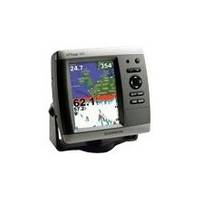
GPSMAP 545 - Marine GPS receiver - 5" color - 640 x 480
Model: 545 Brand: Garmin
This chartplotter provides the brightest, sharpest, most colorful graphics you've ever seen on a 5-inch screen. See clearly as you navigate with the 545's crisp, sunlight-readable VGA display driven by a high-speed processor. This chartplotter offers exceptional detail, fast redraw rates, and the most realistic photo-enhanced cartography ever seen in this class of fixed-mount electronics. The 545 includes detailed offshore maps with Bluechart g2 coverage of the USA and Bahamas. « less
Product Specification
-
General
Product Type: GPS receiverRecommended Use: MarineReceiver: 12 channelCard Reader: SD Memory CardCompatible Software: BlueChart g2 VisionSBAS: WAASDGPS: DGPS readyAccuracy: Position - 49 ft Velocity - 0.16 ft/sec Position - 10 ft ( with WAAS )Update Rate: 1/secondFeatures: Optional external GPS antenna connectionFirst Seen On Google Shopping: February 2007 -
Display
Type: LCD - colorDiagonal Size: 5"Resolution: 640 x 480Features: Adjustable brightness -
Acquisition Times
Warm: 15 secCold: 45 sec -
Connections
Interfaces: Antenna -
Miscellaneous
Design Features: Rugged caseProtection: WaterproofWaterproof Standard: IPX7Included Accessories: Protective cover, mounting bracket -
Dimensions & Weight
Width: 5.9 inDepth: 2.9 inHeight: 6.4 inWeight: 1.8 lbs -
Environmental Parameters
Min Operating Temperature: 5 °FMax Operating Temperature: 131 °F -
Universal Product Identifiers
Part Numbers: 010-00601-00, 545GTIN: 00689076111041, 00753759066154, 00753759075866
Related Products
-
AP35-6 Autopilot with AP35, J300X, Rudder Feedback RF300, RPU-160 Drive Unit (for Hydraulic Steering) sap35-6
-
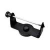
GPS receiver marine swivel mounting bracket
-
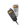
Marine HM195 Commandmic IV - HM195 Mic
-
Max EN-M299 W8 Baltic Sea and Denmark-MAX
-
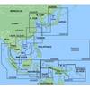
MapSource BlueChart - Yellow Sea - Maps
-
Hawkeye DF2200PX - Fishfinder - portable - included transducer
-
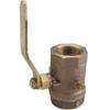
0825004PLB Seacock Body 1/2in Bronze
-
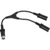
M101RYC-RET Y Cable for Marine Receivers for Dual Remotes
-
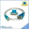
USB to RS232 DB9 male(Serial) / DB25 Male Converter Cable
-
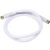
3ft RG6 (18AWG) 75OHM, Quad Shield, CL2 Coaxial Cable with F Type Connector - White
-
Wiring Device-Kellems HBL27CM13 20A 125/250V L14-30R Yellow/White TWIST-LOCK[REG] Chem-Marine Connector
-
760020-1 ad 926 Transducer Adapter Cable-7-pin