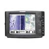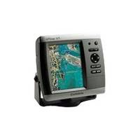
GPSMAP 525s - Marine Chartplotter - 5" color - 480 x 640
Model: 525s Brand: Garmin
This chartplotter provides the brightest, sharpest, most colorful graphics you've ever seen on a 5-inch screen. See clearly as you navigate with the 525's crisp, sunlight-readable VGA display driven by a high-speed processor. This chartplotter offers exceptional detail, fast redraw rates, and the most realistic photo-enhanced cartography ever seen in this class of fixed-mount electronics. The 525's worldwide basemap can be enhanced with the optional BlueChart g2 Vision card, which provides high-resolution aerial reference photos for help navigating tricky harbors and channels - or locating spots like area marinas, fuel stops or restaurants. The g2 Vision plug-in SD data card also allows the GPSMAP 525 to graphically depict a true 3D "mariner's eye" topside view or "fish eye" underwater navigation perspective. With fewer buttons to push and fewer operational steps to navigate, the GPSMAP 525's simplified menu format makes it easy for you to see and select the data you want to access on-screen. The 525s comes with powerful dual frequency or dual beam sonar to clearly paint depth contours, fish targets, structure, etc. It's also CANet capable, allowing sounder data to be shared with other plotter displays on your boat. « less
Product Specification
-
General
Product Type: ChartplotterRecommended Use: MarineReceiver: 12 channelCard Reader: SD Memory CardInterface: NMEA 0183Included Software: Garmin Worldwide Marine BasemapCompatible Software: BlueChart g2 VisionSBAS: WAASDGPS: DGPS readyAntenna: Built-inAccuracy: Position - 49 ft Velocity - 0.16 ft/sec Position - 10 ft ( with WAAS )Update Rate: 1/secondFeatures: Depth sounder, optional external GPS antenna connection, alarmFirst Seen On Google Shopping: February 2007 -
Display
Type: LCD - colorDiagonal Size: 5"Resolution: 480 x 640Features: Adjustable brightness -
Transducer
Transducer Presence: Included transducerMaximum Depth: 1500 ftOperating Frequency: 50/200 kHz -
Acquisition Times
Warm: 15 secCold: 45 sec -
Navigation
Waypoints: 1500Tracklog Points: 10000Routes: 20 -
Connections
Interfaces: Antenna -
Power
Low Voltage Power: DC 10 - 35 V -
Miscellaneous
Design Features: Rugged caseProtection: WaterproofWaterproof Standard: IPX7Included Accessories: Protective cover, mounting bracket -
Dimensions & Weight
Width: 5.9 inDepth: 2.9 inHeight: 6.4 inWeight: 1.8 lbs -
Environmental Parameters
Min Operating Temperature: 5 °FMax Operating Temperature: 131 °F -
Universal Product Identifiers
Part Numbers: 010-00598-00, 010-00598-01, 525sGTIN: 00753759066123, 00753759066475
Related Products
-
T70047 E97 Multifunction Display w/Sonar - US Inland Charts
-
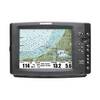
1100 Series 1197c SI Combo NVB - Fishfinder - included transducer : XHS-9-HDSI-180-T - dual-beam
-
3G Broadband Radar Dome with 10 Meter Cable for HDS models 000-10418-001 c41760
-
International Platform Radar Mounting Standard 975-15
-
Series 50 Classic Stainless Steel Navigation Lights
-
25ft 24AWG Cat5e 350MHz UTP Bare Copper Ethernet Network Cable - Blue
-
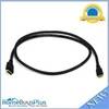
6ft 30AWG High Speed HDMI Cable - HDMI Connector to HDMI Mini Connector - Black
-
25ft 22AWG 5-rca Component Video/audio Coaxial Cable (RG-59/U) - Black
-
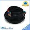
OPC-1000 20' Cable
-
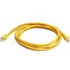
5ft 24AWG Cat6 550mhz UTP Ethernet Bare Copper Network Cable - Yellow
-
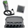
010-00757-01 VHF 300i AIS Marine Radio
-
1100 Series 1155c NVB - Marine Chartplotter - 10.4" color - 800 x 600