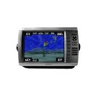
GPSMAP 4210 - Marine Chartplotter - 10.4" color - 800 x 600
Model: 4210 Brand: Garmin
The 4210 combines the power of networking with brilliant color and slim-line design. By connecting to the Garmin Marine Network, you can add sonar, radar and weather.
Product Specification
-
General
Product Type: ChartplotterRecommended Use: MarinePreloaded Maps: USACard Reader: SD Memory CardInterface: NMEA 0183, NMEA 2000Included Software: Garmin Worldwide Marine BasemapCompatible Software: MapSource BlueChart g2, BlueChart g2 VisionSBAS: WAASAntenna: ExternalFeatures: 2D / 3D map perspectiveFirst Seen On Google Shopping: June 2011 -
Display
Type: TFT - colorDiagonal Size: 10.4"Width: 8.3 inHeight: 6.3 inResolution: 800 x 600 -
Navigation
Waypoints: 1500Tracks: 20Tracklog Points: 10000Routes: 20Trip Computer: Sunrise/sunset times, sun/moon positions -
Connections
Interfaces: Garmin Marine Network -
Miscellaneous
Protection: WaterproofWaterproof Standard: IPX7Included Accessories: Protective cover, PC cable, mounting bracket, power cable -
Dimensions & Weight
Width: 13.4 inDepth: 4.2 inHeight: 8.9 inWeight: 7.7 lbs -
Universal Product Identifiers
Part Numbers: 010-00690-01, 4210GTIN: 00753759076047
Related Products
-
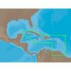
NA-C501 C-Card Format Cuba - Trinidad & Toba
-
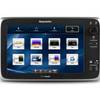
E125 Multifuntion Display - No Preloaded Charts Map
-
25ft 24AWG Cat6 550mhz UTP Ethernet Bare Copper Network Cable - Yellow
-
2529 15ft 28AWG Standard HDMI Cable w/Ferrite cores - Black
-
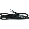
4-Gauge Switch-to-Starter 24 Battery Cable
-
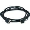
8ft db9/data Token Ring Cable
-
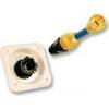
31910-1200 Quick Release Pressure Regulator W Adapter
-
1614g 38 100 Pcs Ring Heat Shrink Connector Blue
-
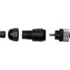
010-11095-00 NMEA 2K Female Connector
-
TM258-8F 1kW 50/200 kHz Transom Mount Transducer 8F Connector
-
5ft 24AWG Cat5e 350MHz UTP Ethernet Bare Copper Network 3375
-
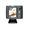
700 Series 747c - Fishfinder - included transducer : XNT-9-20-T - dual-beam