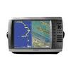
GPSMAP 4012 - Marine GPS receiver - 10.4" color - 800 x 600
Model: 4012 Brand: Garmin
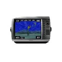
The power of networking meets the brilliance of great design in this large-screen chartplotter, which serves as your all-in-one "nerve center" for the Garmin Marine Network. The GPSMAP 4012 has crisp, video-quality resolution on a large 12" (30.7 cm) XGA display as well as a worldwide, satellite-enhanced basemap. By connecting to the Garmin Marine Network, you can add sonar and radar. The 4012 features a worldwide basemap with high-quality satellite images in place of more traditional maps. And for more detail, you can add maps easily with the Sd card slot without having to connect to a computer. The 4012's high-speed processor draws maps quickly, and its simple intuitive interface makes navigating easy. To keep tabs on your engine room or other area of your boat, you also can connect a live video feed with the 4012's video input and output options. « less
Product Specification
-
General
Product Type: GPS receiverRecommended Use: MarineCard Reader: SD Memory CardInterface: NMEA 0183, NMEA 2000Included Software: Garmin Worldwide Marine BasemapCompatible Software: BlueChart g2 VisionSBAS: WAASAntenna: ExternalFeatures: Optional external GPS antenna connection, alarm, 2D / 3D map perspectiveFirst Seen On Google Shopping: June 2009 -
Display
Type: TFT - colorDiagonal Size: 10.4"Resolution: 800 x 600 -
Navigation
Waypoints: 1500Tracks: 20Tracklog Points: 10000Routes: 20Trip Computer: Sunrise/sunset times, sun/moon positions -
Connections
Interfaces: Garmin Marine Network -
Miscellaneous
Protection: WaterproofWaterproof Standard: IPX7Included Accessories: Protective cover, PC cable, mounting bracket, power cable -
Dimensions & Weight
Width: 13.4 inDepth: 4.2 inHeight: 8.9 inWeight: 7.7 lbs -
Universal Product Identifiers
Part Numbers: 010-00690-00, 4012GTIN: 00753759076030
Related Products
-
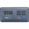
E12199 SmartPilot X-30 SmartPilot Corepack
-
GPS Backtrack Marine Locator Blue Clam Pack MODEL: 360070C
-
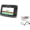
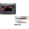
Package(e97 with USA Coastal Chart, 4KW 24 Inch Digital Radome & Radar Cable)
-
Package(E90W, GPS Antenna, 4KW 18 Inch Digital Radome & Radar Cable )
-
TR1 Gold Pilot
-
34891 Marine 400 Medical Kit
-
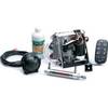
SP-80RLP Autopilot Rotary Feedback No Pump
-
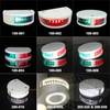
Lopo Light Single Stb Vessel Size 40
-
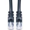
Cat6a Ethernet Cable | 7ft | Black | Network | 10 Gigabit
-
30ft 24AWG Cat6 550mhz UTP Ethernet Bare Copper Network Cable - Orange
-
5ft 24AWG Cat5e 350MHz UTP Bare Copper Ethernet Network Cable - Pink
-
GPSMAP 4012 - Marine GPS receiver - 12.1" color - 1024 x 768