Chart No. 1 Nautical Chart Symbols Abbreviations and Terms [Book]
Chart No. 1 contains a description of the symbols, abbreviations and terms that appear on nautical charts produced by the National Imagery and Mapping Agency, the National Ocean Service and the International Hydrographic Organization.
Product Specification
-
Authors: Griffes, NIMAFormat: paperbackPublication Date: January 1, 2000Key Terms: Plane of Reference, Sector lights, Traffic separation scheme, chart datum, buoy, nautical miles, Racon, Anchorage, Degaussing, nautical charts, World Geodetic System, Fish haven, WHlS, Ash Volcanic, Dot Lt, Supplementary national symbols, Cable Ferry, Loran-C, Submarine power cable, Topmark
-
Universal Product Identifiers
ISBN: 1577852753GTIN: 09781577852759
Related Products
-
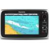
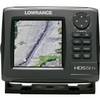
T70027 C97 Multifunction Display w/Sonar - US Inland Charts
-
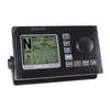
AP50 02 Autopilot System - AP50 2 Autopilot
-
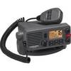
Lvr-250 DSC VHF Fixed-Mount Marine Radio
-
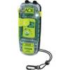
2883 ACR SARLink 406 GPS PLB
-
Marine navigation: piloting and celestial and electronic navigation [Book]
-
000-10520-001 HDS-5m Gen2 Nautic Insight Chartplotter
-
75ft 24AWG Cat6 550mhz UTP Ethernet Bare Copper Network Cable - Red
-
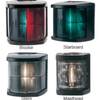
Marine 2 NM Stern Lamp
-
100ft Premium Optical Toslink Cable w/ Metal Fancy Connector
-
1-AR30-10-12 Air 30 Wind Generator 12VDC
-
E42001 - VHF, Ray240, Modular w/Hailer
-
GPSMAP 440 - Marine GPS receiver - 4" color - 240 x 320