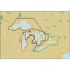
BlueChart g2 Vision - Tampa to New Orleans - Maps
Model: Brand: Garmin
BlueChart g2 Vision offers the same rich detailed charting of BlueChart g2 to help you get the most out of your unit. In addition, g2 Vision features a growing database of high-resolution satellite imagery, above and below the water 3D perspective, auto guidance technology, aerial photographs for real world reference and coastal roads with points of interest. This product features bradenton, FL through New Orleans, LA including Apalachicola, Mobile, the Mississippi Delta, Chandeleur Islands, and a portion of Timbalier Bay. Also covers Lake Ponchartrain. « less
Product Specification
-
General
Product Type: MapsDistribution Media: SD Memory CardFirst Seen On Google Shopping: May 2007 -
Compatibility Information
Designed For: Garmin GPSMAP 4008, 4012, 420, 4208, 420s, 4212, 430, 430s, 430sx, 430x, 440, 440s, 440sx, 440x, 450, 5008, 5012, 520, 5208, 520s, 5212, 525, 525s, 530, 530s, 535, 535s, 540, 540s, 545, 545s, 550, 550s, 555, 555s -
Universal Product Identifiers
Part Numbers: 010-C0713-00, Tampa to New OrleansGTIN: 00753759068936
Related Products
-
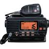
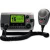
Quest 1500s VHF - Marine Radio
-
Michigan, Huron, No. Chann. & Georgian Bay: NT+ Wide Coverage by C-Map
-
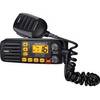
SOLARA-DSC Black Solara Compact Fixed Mount VHF 2-Way Marine Radio - Black
-
2898.91 FBRS 2898 Battery Service - PLB-300 Microfix
-
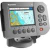
E62184 - A50 5 Chartplotter, Int GPS, w/o Maps
-
NSE8 Navigation Pack - NSE8, GS15 & BR24
-
Circle Cable Clips with Steel Nail, 10mm, 100pcs/Pack
-
TM00701 Power Connector Plastic
-
LTD A3030Y30 30 Amp to 30 Amp Y-Adapter
-
M92-01 Clas D DSC VHF Marine RAD
-
34170 Vhf-200 VHF Radio W/class-d DSC
-
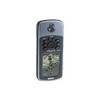
GPSMAP 76 - Marine, hiking GPS receiver - 2.9" monochrome - 240 x 180