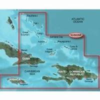
BlueChart g2 Vision - Southern Bahamas - Maps
Model: Brand: Garmin
BlueChart g2 Vision offers the same rich detailed charting of BlueChart g2 to help you get the most out of your unit. In addition, g2 Vision features a growing database of high-resolution satellite imagery, above and below the water 3D perspective, auto guidance technology, aerial photographs for real world reference and coastal roads with points of interest. This product features data from explorer charts for the Bahamas! Detailed coverage from Eleuthera Island, Bahamas to the Dominican Republic, including the Bahamian islands of Great Exuma, Great Inagua, Mayaguana, and many others. Also includes detailed coverage of the Jamaican, Haitian, and Dominican coasts in their entirety, the easternmost quarter of Cuba, and the Turks and Caicos Islands. « less
Product Specification
-
General
Product Type: MapsDistribution Media: SD Memory CardFirst Seen On Google Shopping: May 2007 -
Compatibility Information
Designed For: Garmin GPSMAP 4008, 4012, 420, 4208, 420s, 4212, 430, 430s, 430sx, 430x, 440, 440s, 440sx, 440x, 450, 5008, 5012, 520, 5208, 520s, 5212, 525, 525s, 530, 530s, 535, 535s, 540, 540s, 545, 545s, 550, 550s, 555, 555s -
Universal Product Identifiers
Part Numbers: 010-C0730-00, Southern BahamasGTIN: 00753759069100
Related Products
-
AP5011 Autopilot with AP50, J50, Rudder Feedback RF300, HLD2000L (Long Stroke)
-
CH250BB/60/240 60 kHz Black Box Searchlight Sonar System. Includes 400mm Travel Hoist and Operates at 12VDC
-
Package(c127 with aus, NZ, S. America, Asia Chart, 4KW 24 Inch Digital Radome & Radar Cable)
-
Marlan Inst Hole Cvr 2in Rd Instrument Hole Covers 530001C
-
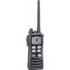
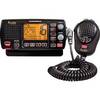
M72 Handheld VHF Radio M-72 Submersible 6W TX c25372
-
2" IPS Intake Strainer Bronze Made in The USA
-
3ft 24AWG Cat5e 350MHz UTP Bare Copper Ethernet Network Cable - Yellow
-
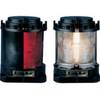
Series 55 Commercial Navigation Lights, Series 55 Stern Light Yellow
-
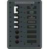
8027 AC Main + 6 Positions
-
1- Light Bar for 18" or Smaller SatDomes - Requires Ltb Top, LTB-S
-
Electronics - MRF80B-D - MR-F80BD Marine Radio for Marine
-
FCF12000 Kit with AC, Seawater & Ducting - 115V FCFK020A