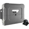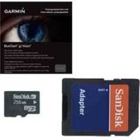
BlueChart g2 Vision - North Maine - Maps
Model: Brand: Garmin
BlueChart g2 Vision offers the same rich detailed charting of BlueChart g2 to help you get the most out of your unit. In addition, g2 Vision features a growing database of high-resolution satellite imagery, above and below the water 3D perspective, auto guidance technology, aerial photographs for real world reference and coastal roads with points of interest. From Calais to Camden, including Bar Harbor and Penobscot Bay. « less
Product Specification
-
General
Product Type: MapsDistribution Media: SD Memory CardFirst Seen On Google Shopping: May 2007 -
Compatibility Information
Designed For: Garmin GPSMAP 4008, 4012, 420, 4208, 420s, 4212, 430, 430s, 430sx, 430x, 440, 440s, 440sx, 440x, 450, 5008, 5012, 520, 5208, 520s, 5212, 525, 525s, 530, 530s, 535, 535s, 540, 540s, 545, 545s, 550, 550s, 555, 555s -
Universal Product Identifiers
Part Numbers: 010-C0702-00, North MaineGTIN: 00753759068820, 00957696612775
Related Products
-
CH250BB/88/340 88 kHz Black Box Searchlight Sonar System. Includes 400mm Travel Hoist and Operates at 24 & 32VDC
-
Package(e95 with USA Coastal Chart, 4KW 24 Inch Digital Radome & Radar Cable)
-
Radar 5015 Package with GMR24HD 4KW Radome & GSD22 Sounder
-
T70054 E125 Multifunction Display w/ROW Charts
-
E12205 X-Sol Corepack Use with Solenoid Drive Systems
-
Toslink Digital Optical Audio Cable 1.5 ft.
-
Video / audio cable - Male RCA to M RCA
-
Fiber Optic Cable, LC/SC, Multi Mode, Duplex - 10 Meter 2630
-
Electronics Corporation Mrf80bd New-radio Mr F80B-D Marine VHF
-
Cat6a Ethernet Cable | 15ft | Black | Network | 10 Gigabit
-
3ft 24AWG Cat6 550mhz UTP Ethernet Bare Copper Network Cable - Orange
-
Meridian - Marine, hiking GPS receiver - Monochrome - 120 x 160