BlueChart g2 Vision - New York - Maps
Model: Brand: Garmin
BlueChart g2 Vision offers the same rich detailed charting of BlueChart g2 to help you get the most out of your unit. In addition, g2 Vision features a growing database of high-resolution satellite imagery, above and below the water 3D perspective, auto guidance technology, aerial photographs for real world reference and coastal roads with points of interest. PThis product features providence to New York, includes Narragansett Bay, all of Long Island, the entire Hudson River, New York Harbor through Perth Amboy and Brick Township. « less
Product Specification
-
General
Product Type: MapsDistribution Media: SD Memory CardFirst Seen On Google Shopping: May 2007 -
Compatibility Information
Designed For: Garmin GPSMAP 4008, 4012, 420, 4208, 420s, 4212, 430, 430s, 430sx, 430x, 440, 440s, 440sx, 440x, 450, 5008, 5012, 520, 5208, 520s, 5212, 525, 525s, 530, 530s, 535, 535s, 540, 540s, 545, 545s, 550, 550s, 555, 555s -
Universal Product Identifiers
Part Numbers: 010-C0705-00, New YorkGTIN: 00753759068851
Related Products
-
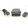
S1000 Autopilot Wireless E12169 C16576
-
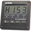
SP110 Autopilot
-
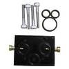
010-11201-00 Autopilot Unbalanced Valve Kit
-
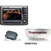
Package(E90W, GPS Antenna, DSM300G Sounder, 4KW 24 Inch Digital Radome & Radar Cable )
-
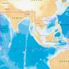
31XG/CF Indian Ocean and South China Sea Gold
-
5209; Map-Roosevelt Lake
-
4123 La &Amp; Orange County Inshore
-
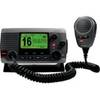
010-00754-00 - VHF 100, Basic, Grey
-
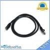
Ethernet Category 5 Enhanced RJ45 Network Patch Cable - 3'
-
COUP30B 30 Amp Watertight Connecting Coupler Assembly
-
809-0916 AGS Automatic Generator Start F First Gen
-
E62190-US - A70 6.4 Chartplotter, US Maps, Int GPS