BlueChart g2 Vision - Lake Superior - Maps
Model: Brand: Garmin
BlueChart g2 Vision offers the same rich detailed charting of BlueChart g2 to help you get the most out of your unit. In addition, g2 Vision features a growing database of high-resolution satellite imagery, above and below the water 3D perspective, auto guidance technology, aerial photographs for real world reference and coastal roads with points of interest. This product features detailed Lake Superior and northern Lake Huron are covered in detail for the U.S. portion from Duluth through Alpena, including Crooked Lake, Burt Lake, and Mullett Lake in Michigan; and for the Canadian portion from Thunder Bay to Tobermory, Ont. « less
Product Specification
-
General
Product Type: MapsDistribution Media: SD Memory CardFirst Seen On Google Shopping: May 2007 -
Compatibility Information
Designed For: Garmin GPSMAP 4008, 4012, 420, 4208, 420s, 4212, 430, 430s, 430sx, 430x, 440, 440s, 440sx, 440x, 450, 5008, 5012, 520, 5208, 520s, 5212, 525, 525s, 530, 530s, 535, 535s, 540, 540s, 545, 545s, 550, 550s, 555, 555s -
Universal Product Identifiers
Part Numbers: 010-C0716-00, Lake SuperiorGTIN: 00753759068967
Related Products
-
44484 Structure Scan HD w/ Xdsr LSS-2
-
FR8252-6 Open Array Radar
-
LMB-A2 for SI-TEX Simrad et Al Domes
-
DVD Raymarine E Series E80 E120 Radar N7802DVD
-
1964CBB Radar Chartplotter, Black Box, 6' Antenna & C-Map
-
The Nautical Chart - 11 x 17 Movie Poster - Spanish Style A
-
Adjustable Tilting/Swiveling Wall Mount Bracket for LCD LED Plasma - Corner Friendly (Max 125Lbs, 32~60inch) (REV.2.0)
-
4KW 24in Radome No Cable E52080
-
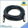
25ft Premier Series XLR Male to XLR Female 16AWG Cable (Gold Plated) [Microphone & Interconnect]
-
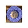
Bulk cable - CAT 5e - Unshielded twisted pair (UTP) 1000 ft - Purple
-
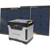
Goal Zero Yeti 1250 Portable Solar Backup Power 39004
-
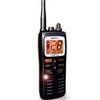
MHS125 Floating HH VHF