BlueChart g2 Vision - Lake Michigan - Maps
Model: Brand: Garmin
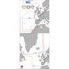
BlueChart g2 Vision offers the same rich detailed charting of BlueChart g2 to help you get the most out of your unit. In addition, g2 Vision features a growing database of high-resolution satellite imagery, above and below the water 3D perspective, auto guidance technology, aerial photographs for real world reference and coastal roads with points of interest. This product features detailed coverage of Lake Michigan in its entirety and northern Lake Huron from Cheboygan, MI, to Blind River, Ont., including Sault Ste. Marie and Cockburn Island. « less
Product Specification
-
General
Product Type: MapsDistribution Media: SD Memory CardFirst Seen On Google Shopping: May 2007 -
Compatibility Information
Designed For: Garmin GPSMAP 4008, 4012, 420, 4208, 420s, 4212, 430, 430s, 430sx, 430x, 440, 440s, 440sx, 440x, 450, 5008, 5012, 520, 5208, 520s, 5212, 525, 525s, 530, 530s, 535, 535s, 540, 540s, 545, 545s, 550, 550s, 555, 555s -
Universal Product Identifiers
Part Numbers: 010-C0717-00, Lake MichiganGTIN: 00753759068974
Related Products
-
TRAWLPLOT 12 SD Color Chartplotter w/WAAS Receiver
-
000-10619-001 Triton Pilot Add-on System - High Current
-
BlueChart g2 Vision - Hecate Strait South - Maps
-
Max EW-M227 W3 Norhtwest European Coasts-MAX
-
Marine RADIO-FIX VHF Class-D DSC White (143-MRF45D)
-
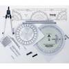
100 Marine Navigation Coast Guard Navigation Tool Kit
-
MA7060 Marine Speaker Panel 140 Watt (Pair) c12285
-
7ft 24AWG Cat6 500mhz Crossover Ethernet Bare Copper Network Cable - Orange
-
Bulk cable - CAT 6 - Unshielded twisted pair (UTP) 1000 ft - White
-
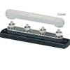
2303 Busbar 4x1/4in Stud Common Bu
-
15ft 32AWG Mini DisplayPort Cable - White
-
Patch cable - CAT 5e - RJ-45 - M - Unshielded twisted pair (UTP) 100 ft - Red