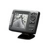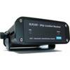
AIS Dual Synthesised Rcvr w/GPS SLR-200G
Model: SLR-200G Brand: Milltech Marine
Connected to a PC, via a serial port, running a compatible Navigation Program, or a dedicated Marine Chart Plotter, via the NMEA output, collision avoidance information can be displayed on screen giving the operator a visual interpretation of the name, position, course and speed of AIS transmitting vessels within VHF range. Any NMEA input data at 4800 Baud can be connected into the unit, this is combined with the AIS data and will be output at 4800 or 38.4K, avoiding the requirement of installing an external multiplexer. « less
Product Specification
-
Universal Product Identifiers
Part Number: SLR-200G
Related Products
-
11106748 - Weigh Boat Holder (Each)
-
Mark 5x - Fishfinder - included transducer : Skimmer
-
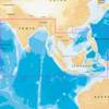
31XG/CF Indian Ocean and South China Sea Gold
-
2774NH.91 FBRS 2774NH Non-Hazmat Battery Replacement S
-
Adventure Medical 0115-3000 Kit Marine 3000
-
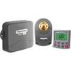
Smartpilot SPX-5R Sport Autopilot - E12220
-
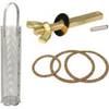
0493DP999M Cork Gasket Kit Sizes 8, 9, 10
-
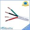
250ft 12AWG CL2 Rated 4-Conductor Loud Speaker Cable (for In-Wall Installation)
-
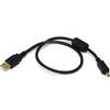
1.5ft USB 2.0 A Male to Mini-B 4pin Male 28/24AWG Cable w/ Ferrite Core (Gold Plated)
-
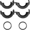
010-11170-01 - Split Connector Collar, Threaded, RJ45
-
115V Seawater and Air Distribution Kit for 12,000 BTU Units
-
AIS Network Dual Channel Rcvr w/GPS