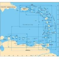
A28 Imray Guadeloupe Marine Nautical Chart
Model: A28 Brand: Weems And Plath
Francois and Marina de la Gde Saline Marine de Riviere Sens and Iles de la Petite Terre. The chart is flat with no folds so is suitable for framing. Size: 25 x 35-1/2 (640 x 900 cm).
Product Specification
-
Universal Product Identifiers
Part Number: A28
Related Products
-
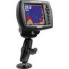
Double Socket Arm F/ Garmin Fixed Mount GPS 1"
-
Package(c125 with aus, NZ, S. America, Asia Chart, 4KW 24 Inch Digital Radome & Radar Cable)
-
Max IN-M202 W67 Maldives to Gulf of Martaban-MAX
-
Bahamas: NT+ Wide Coverage by C-Map
-
MSD/2XG Gold Canada & Southeast Alaska on SD/MicroSD
-
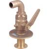
0834006PLB Seacock w/Curved TP 1in
-
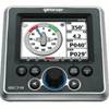
GSC Autopilot with Rudder feedback. No Drive 7000471
-
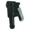
18-8092 3/8 in. Fuel Connector
-
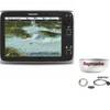
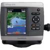
GPSMAP 421s - Marine Chartplotter - 4" color - 240 x 320
-
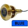
Lumishore Thru-Hull Flush Fit Underwater Light - Blue - 18W #THX18-B
-
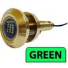
Lumishore Thru Hull Flush Fit 36 Watt Green Underwater Light 41684
-
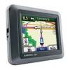
n�vi 550 - Hiking, automotive, motorcycle GPS receiver - 3.5" color - 320 x 240