8268; Map-The Delta
Model: 8268 Brand: Fish-n-Map
FISH-N-MAP UNDERWATER TOPOGRAPHY MAPSMade of waterproof, tear resistant plastic. Features include: underwater depth contours, fish locations, latitude and longitude for GPS, multiple freshwater lakes on one map, boat ramps, recreational facilities and much more.
Product Specification
-
Universal Product Identifiers
Part Numbers: 164527, 8268, MSI432492GTIN: 00761428082688
Related Products
-
TP22 Tiller Autopilot ( Up to 36' and 11000Lbs) c16714
-
5 Instrument Pod Un-Cut GP150
-
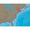
NA-C302 Furuno FP Format Cape Cod Long Is & Hudson R
-
Active Pass,Porlier Pass/et Montague Harbour Chart
-
Canadian Charts Qu.Charlot Str.W.Portion/Bull Harb.
-
2" IPS Intake Strainer Bronze Made in The USA
-
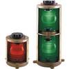
Double Lens, 360� Navigation Lights, 120V Volts, White
-
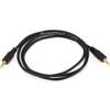
4634 3ft 2.5mm Stereo Plug/Plug M/M Cable - Black
-
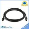
589 6ft S-Video Svideo M/F Extension Cable
-
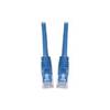
Patch cable - CAT 6 - RJ-45 - M - Unshielded twisted pair (UTP) 10 ft - Blue
-
18-8078 Suzuki Male Fuel Connector
-
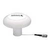
Terk Sirmarine Satellite Radio Antenna