5202; Map-Apache/Saguaro/Canyon Res
Model: 5202 Brand: Fish-n-Map
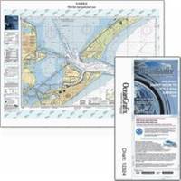
FISH-N-MAP UNDERWATER TOPOGRAPHY MAPSMade of waterproof, tear resistant plastic. Features include: underwater depth contours, fish locations, latitude and longitude for GPS, multiple freshwater lakes on one map, boat ramps, recreational facilities and much more.
Product Specification
-
Universal Product Identifiers
Part Numbers: 249840, 5202GTIN: 00761428052025
Related Products
-
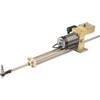
21113386 HLD-2000 MK2LS Long Split Hydraulic Linear Drive Unit
-
Package(e97 with USA Coastal Chart, 4KW 24 Inch Digital Radome & Radar Cable)
-
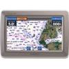
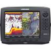
GPSMAP 640 - Marine, automotive Chartplotter - 5.2" color - 800 x 480
-
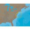
NA-C303 Furuno FP Format Shinnecock Bay Albe
-
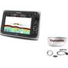
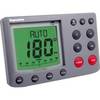
E12099-P M ST7002 Plus Control Head Surface Mount
-
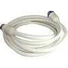
50 Amp 25' Cord Set - White - 125/250V
-
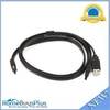
3ft eSATA + USB to Esatap Cable - Black
-
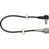
DA23M - Antenna Adapter Cable for Motorola MOTOROKR
-
10543001 HDS-10 Gen2 Inst USA w/o XD
-
SP-BL Transom Mount Speed Sensor Blue Connector wspbl
-
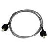
A62246 - Seatalk Hs Dual End Network Cable 15m
-
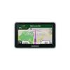
n�vi 2350 - Automotive GPS receiver - 4.3" color - 480 x 272 - widescreen