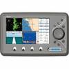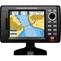
5" GPS Chartplotter W/MAPS
Model: Brand: Standard Horizon
Standard Horizon CP190i CP190i 5 Internal GPS Chart Plotter with built-in C-Map Cartography The CP190i comes preloaded with detailed maps for coastal navigation of the USA, Great Lakes, Canada, Hawaii, Mexico and the Bahamas. The best value GPS Chart Plotter in its class, the CP190i boasts a crisp 320x240 direct sunlight viewable 5-inch color TFT display and is supplied with a swivel bracket and flush mount hardware. The CP190i is capable of navigating you quickly and accurately to your destination. Achieve up to 10 accuracy with the integrated 50 channel WAAS GPS receiver or with the optional external GPS Smart antenna. Dedicated MARK, ROUTE and INFO keys allow for fumble free operation. To find fish, wrecks and record water temperature, simply connect the optional FF525 50 200 kHz black box fish finder and transducer. In addition, the CP190i displays Vessel positions when connected to DSC radio calls and tracks AIS Automatic Identification System targets when connected to an op « less
Product Specification
-
Universal Product Identifiers
Part Numbers: 12008298, 40649, CP190I, DEF-258478, Standard Horizon CP190iGTIN: 00788026124084
Related Products
-
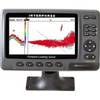
iScan V90 Forward Looking Sonar 16407
-
WPC076; Chart Book Booths Bay Maine
-
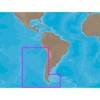
SA-C002 Furuno FP Format - Chile
-
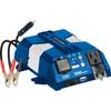
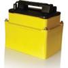
Marine 500 Watt Inverter w/ USB Port 7637
-
The Nautical Chart: A Novel of Adventure [Book]
-
EC7I 7 Inch Color Plotter with Internal GPS
-
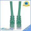
Cat6a Ethernet Cable | 2ft | Green | Network | 10 Gigabit
-
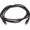
644 6ft 3.5mm Stereo Plug/Plug M/M Cable - Black
-
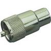
329900-1 UHF Connector Male F/8U Cable
-
527ID-IHN in Hull Ducer No Connector
-
B45-DT-DX 600W Thru-Hull Transducer Lowrance 7-Pin Gray Connector
-
Energy ME-AGS Automatic Generator Start