Hydrographical Surveying: A Description of the Means and Methods Employed in Construcing Marine Charts [Book]
Unlike some other reproductions of classic texts (1) We have not used OCR(Optical Character Recognition), as this leads to bad quality books with introduced typos. (2) In books where there are images such as portraits, maps, sketches etc We have endeavoured to keep the quality of these images, so they represent accurately the original artefact. Although occasionally there may be certain imperfections with these old texts, we feel they deserve to be made available for future generations to enjoy. « less
Product Specification
-
Authors: W. J. L. (William James Lloyd) WhartonPages: 418Format: paperbackPublication Date: 2012.08
-
Universal Product Identifiers
ISBN: 1290730547GTIN: 09781290730549
Related Products
-
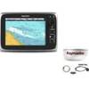
Package(c95 with USA Coastal Chart, 4KW 18 Inch Digital Radome & Radar Cable)
-
HPWIC3 Map, Wisconsin, Electronic Chart
-
NaC313 CCard Format Muscongus Bay Cape May Bathy
-
3208 l. Powell So
-
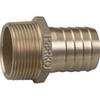
0076010PLB 2 1/2 Pipe to Hose Adapter
-
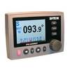
20110003 SP-36 Second Station Kit W/25' Cable
-
25ft 24AWG Cat6 550mhz UTP Ethernet Bare Copper Network Cable - White
-
Marine Products Plug Wire Set 9-28004
-
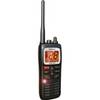
Submersible Hand-Held 2-Way VHF Marine Radio Uniden MHS125
-
Marine network cable
-
1ft 24AWG Cat5e 350MHz UTP Bare Copper Ethernet Network Cable - Red
-
115V Seawater and Air Distribution Kit for 9,000 BTU Units