Elements of Navigation, Chart, Lead, & Log Deviation & Compass Compensation, Piloting, Dead Reckoning, Nautical Tables [Book]
This historic book may have numerous typos and missing text. Purchasers can download a free scanned copy of the original book (without typos) from the publisher. Not indexed. Not illustrated. 1909 Excerpt: ...proceed as follows: From c, Fig. 21, representing the compass point ESEjE, draw a line perpendicular to a b; then, with the scale, measure the distance cd, which, in this case, is equivalent to 62 divisions, or 6.5. Since the curve at that point lies to the east, the deviation is easterly; hence, the deviation for ESEiE is 6.5 E. In a like manner, the deviation for any intermediate point, quarter or half point, may be found directly from the diagram. It will be noticed in this diagram that there is no deviation on S E by S and N by W headings. 65. Napier's Deviation Diagram.--For larger deviations and greater accuracy, the diagram shown in Fig. 22, called Napier's diagram, after its inventor, is commonly used. The construction of this diagram is as follows: A vertical line is drawn near the center of a sheet of paper of suitable size, and on this line, at equal distances, are marked the thirty-two points of the compass, beginning with north at the top. These points are named in the regular order in In Fig. 22, the diagram is divided into two parts, the top of the right-hand part being a continuation of the lower end of the left-hand part. 66. How the Curve is Drawn.--The curve shown in Fig. 22 corresponds to the deviations given in Table IV; it is drawn in the following manner: The deviation for north is 14 W; hence, 14 is scaled according to the graduated vertical line, and this distance is then laid off to the left on the dotted line passing through the north point, thus locating the point a. If the deviation is east, as on the S S E heading, the corresponding distance is laid off to the right, and on the dotted line passing through the S S E point, locating b. After all the deviations have been similarly scaled off and marked with a light cross on the do... « less
Product Specification
-
Authors: International SchoolsPages: 72Format: paperbackPublication Date: March 6, 2012
-
Universal Product Identifiers
ISBN: 1130180921GTIN: 09781130180923
Related Products
-
CP450C ClearPulse Chirp Sonar E102143 c44376
-
CH250BB/88/340 88 kHz Black Box Searchlight Sonar System. Includes 400mm Travel Hoist and Operates at 24 & 32VDC
-
GMR 606 XHD Radar 6ft6kw Pedestal Array
-
LMB-A2 for SI-TEX Simrad et Al Domes
-
Marine Navigation: Celestial and electronic [Book]
-
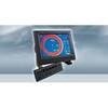
Adjustable Tilting Wall Mount Bracket for LCD LED Plasma (Max 165Lbs, 30~63inch) - Black
-
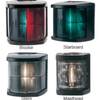
Marine Navigation Lights for Boats to 65'7" Masthead Series
-
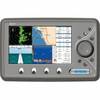
EC7IF Chartplotter w/Internal Antenna & Fishfinder Tan / Red
-
Marine Products Plug Wire Set 9-28015
-
Marine Products Plug Wire Set 9-28038
-
SP-BL Transom Mount Speed Sensor Blue Connector wspbl
-
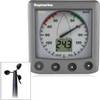
26235 ST60 Plus Wind System with Rotavecta Wind Transducer