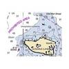
4123 La &Amp; Orange County Inshore
Model: 4123 Brand: Fish-n-Map
FISH-N-MAP UNDERWATER TOPOGRAPHY MAPSMade of waterproof, tear resistant plastic. Features include: underwater depth contours, fish locations, latitude and longitude for GPS, multiple freshwater lakes on one map, boat ramps, recreational facilities and much more.
Product Specification
-
Universal Product Identifiers
Part Number: 4123GTIN: 00761428041234
Related Products
-
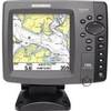
700 Series 786ci - Marine Chartplotter - 5" color - 640 x 640
-
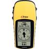
eTrex H - iking GPS receiver - Monochrome - 64 x 128
-
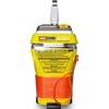
MT-403G AccuSat 406 Cat 2 EPIRB Intern GPS Non-Hazmat Withbracket
-
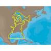
30128 Max - U.S. Gulf Coast and Inland Rivers - C-Card
-
NOAA Cape Blanco-Yaquina Head
-
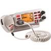
GB0869 VHF Marine Large Screen Radio
-
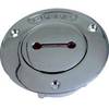
Deck Plates, Fills for Pipe, 1", Unmarked, Bronze
-
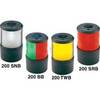
Navigation Light Sern #0200SNTDP1
-
1554 6ft Mini Optical Toslink M/M 5.0mm OD Molded Cable
-
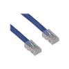
Patch cable - CAT 6 - RJ-45 - M - Unshielded twisted pair (UTP) 100 ft - Blue
-
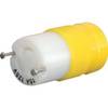
4731CR Female Connector 15A 125V
-
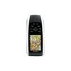
GPSMAP 78 - Marine, hiking GPS receiver - 2.6" color - 160 x 240