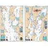
Description of a New Improved Chart of the Islands of Shetland to Which Are Annexed Three Copper Plates and a Special Chart of Valey-Sound, Published from the Royal Danish Marine Archives for Draughts and Charts by P. de Lowenorn, 1787. [Book]
Model: 1787 Brand:
The 18th century was a wealth of knowledge, exploration and rapidly growing technology and expanding record-keeping made possible by advances in the printing press. In its determination to preserve the century of revolution, Gale initiated a revolution of its own: digitization of epic proportions to preserve these invaluable works in the largest archive of its kind. Now for the first time these high-quality digital copies of original 18th century manuscripts are available in print, making them highly accessible to libraries, undergraduate students, and independent scholars.Rich in titles on English life and social history, this collection spans the world as it was known to eighteenth-century historians and explorers. Titles include a wealth of travel accounts and diaries, histories of nations from throughout the world, and maps and charts of a world that was still being discovered. Students of the War of American Independence will find fascinating accounts from the British side of conflict. ++++The below data was compiled from various identification fields in the bibliographic record of this title. This data is provided as an additional tool in helping to insure edition identification: ++++Bodleian Library (Oxford)T193960Copenhagen: printed by Frideric William Thiele, [1787] 12p., plates: map; 4 « less
Product Specification
-
Authors: Poul LvenrnPages: 28Format: paperbackPublication Date: 2010.08
-
Universal Product Identifiers
ISBN: 1171408943GTIN: 09781171408949
Related Products
-
Package(E90W, GPS Antenna, DSM300G Sounder, 4KW 24 Inch Digital Radome & Radar Cable )
-
GMR 604 XHD Radar - 4 ft. 6KW Pedestal Array
-
NT Cape COD/LI/HUD River NAC302
-
Lake Champlain Fishing North - Waterproof Charts
-
8235 Meter Digital DC Voltage
-
Shore Power Cable 6/4 Yellow Per/Ft
-
IEEE-1394 FireWire iLink DV Cable 6P-6P M/M - 15ft (Clear)
-
Hook Cable Clips with Steel Nail, 15mm, 100pcs/Pack
-
300ft 16AWG Enhanced Loud oxygen- Copper Speaker Wire Cable
-
10ft Premium 3.5mm Stereo Male to 2rca Male 22AWG Cable 5599
-
TNC-Cp/Gs-01 Connector for Rg-58Ua Cable
-
Mounting Kit for Wind Turbines - Marine Applications, Model#