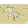
3208 l. Powell So
Model: 3208 Brand: Fish-n-Map
FISH-N-MAP UNDERWATER TOPOGRAPHY MAPSMade of waterproof, tear resistant plastic. Features include: underwater depth contours, fish locations, latitude and longitude for GPS, multiple freshwater lakes on one map, boat ramps, recreational facilities and much more.
Product Specification
-
Universal Product Identifiers
Part Numbers: 250129, 3208GTIN: 00761428032089
Related Products
-
Michigan, Huron, No. Chann. & Georgian Bay: NT+ Wide Coverage by C-Map
-
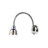
Ocean Chart Lamp, Medium
-
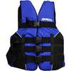
LJ-SMED - Adult Life Vest Size Small/Medium
-
GSC Autopilot No Rudder Feed Back or Drive 700048-1
-
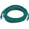
20ft 24AWG Cat5e 350MHz UTP Bare Copper Ethernet Network Cable - Green
-
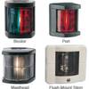
Marine 3562 Series Navigation Lights Flush Mount Stern (White
-
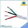
250ft 16AWG CL2 Rated 4-Conductor Loud Speaker Cable (for
-
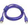
6ft 28AWG High Speed HDMI Cable w/Ferrite cores - Purple
-
CONNECTOR, Female Tab 22-18 x .187 25 Per Package
-
1ft 24AWG Cat6 550mhz UTP Ethernet Bare Copper Network Cable - Red
-
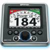
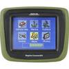
CrossoverGPS 2500T - Marine, hiking, automotive GPS receiver - 3.5" color
-
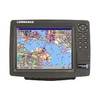
GlobalMap 9200C - Marine GPS receiver - 10.4" color - 600 x 800