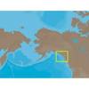
010-C1025-10 Bluechart G2 HEU718LMediterranean Sea Data Card
Model: 010-C1025-10 Brand: Garmin
See your surroundings more clearly with BlueChart g2 data. With BlueChart g2, you'll get detailed marine cartography that provides convenient viewing of nautical content. BlueChart g2 allows you to see your vessel's precise, on-chart position in relation to naviads, coastal features, anchorages, obstructions, waterways, restricted areas and more. You will also have access to detailed mapping capabilities that include Safety Shading, Fishing Charts, smooth data transition between zoom levels, harmonious transition across chart borders, and reduction of chart discontinuities. Covers: Detailed offshore coastal coverage of the Mediterranean Sea in its entirety. Coverage features the Strait of Gibraltar, the Balearic Islands, the French Riviera, Corsica, Sardinia, Sicily, the Adriatic Sea, the Greek Islands, the Aegean Sea, the Dardanelles and Bosporus Straits, the Sea of Marmara, Cyprus, the Suez Canal, Tripoli and Algiers Harbors, and the Gulfs of Gabes and Tunisia. « less
Product Specification
-
Universal Product Identifiers
Part Numbers: 010-C1025-10, 10807287, 35821GTIN: 00753759096243
Related Products
-
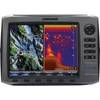
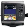
HDS-10 No Transducer - 140-41
-
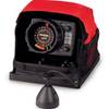
LX-5 Dual Beam True Color Sonar Flasher System
-
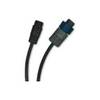
8M0029351 Wireless Sonar Adapter Garmin 6-Pin
-
NA-C801 Furuno FP Format Dixon Entrance - Icy Bay
-
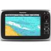
E70011 C95 Multifunction Display - No Charts Preloaded
-
Paper Chart Kit Book Region 04 Ches Bay and Del Bay
-
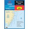
Waterproof Chart Kit - New Jersey Coast 35271
-
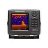
HDS 5x Gen2 - Fishfinder
-
GPSMAP - 541/541s - v.2.3 - GPS software
-
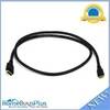
6ft 30AWG High Speed HDMI Cable - HDMI Connector to HDMI Mini Connector - Black
-
200-020 - Masthead Round w/anchor - 2 Nm - LED Navigation Light
-
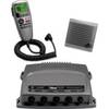
VHF 300 AIS VHF Radio with AIS Receiver