010-C1020-20 Bluechart G2 HXPC024RAustralia & New Zealand
Model: 010-C1020-20 Brand: Garmin
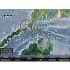
See your surroundings more clearly with BlueChart g2 data. With BlueChart g2, you'll get detailed marine cartography that provides convenient viewing of nautical content. BlueChart g2 allows you to see your vessel's precise, on-chart position in relation to naviads, coastal features, anchorages, obstructions, waterways, restricted areas and more. You will also have access to detailed mapping capabilities that include Safety Shading, Fishing Charts, smooth data transition between zoom levels, harmonious transition across chart borders, and reduction of chart discontinuities. Covers: Detailed coverage of the entire continent of Australia and New Zealand. Coverage includes Brisbane, Sydney, and the Great Barrier Reef along the Eastern coast. Coverage continues along the Southern coast including Melbourne, Adelaide, and Tasmania through the Great Australian Bight. Coverage also includes Perth, Geraldton, Darwin, and the Gulf of Carpentaria on the Western and Northern coasts. « less
Product Specification
-
Universal Product Identifiers
Part Numbers: 010-C1020-20, 10807238, 35814GTIN: 00753759095499
Related Products
-
CH250BB/60/340 60 kHz Black Box Searchlight Sonar System. Includes 400mm Travel Hoist and Operates at 24 & 32VDC
-
Package(E90W, GPS Antenna, DSM300G Sounder, RA1072HD 4KW 72 Inch HD Digital Open Array Radar & 15m Radar Cable )
-
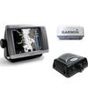
Radar 5008 Package with GMR24HD 4KW Radome & GSD22 Sounder
-
MapSource BlueChart - Italy, Adriatic Sea - Maps
-
000-10041-001 Nautic Insight HD US Coastal East
-
Lopo Light Single Stb Vessel Size 40
-
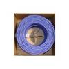
Bulk cable - CAT 5e - Unshielded twisted pair (UTP) 1000 ft - Purple
-
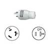
Power connector adapter - power NEMA L5-30 - M - power NEMA 5-20 - F - PC
-
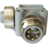
ELB-NM-NF Mini 90 Deg. Male to Female Connector
-
3ft 24AWG Cat6 550mhz UTP Ethernet Bare Copper Network Cable - Gray
-
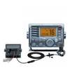
M504A 73 M504 with Remotable Mic - Gray
-
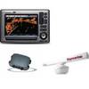
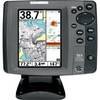
700 Series 757c Combo CHO - Marine Chartplotter - 5" color - 240 x 320