010-C0924-10 Bluechart G2 HAW005RThe Gulf & Red Sea Data Card
Model: 010-C0924-10 Brand: Garmin
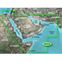
HAW005R Covers: Coverage of the Arabian Penninsula beginning at the Mediterranean Sea from Beirut to Alexandria. Coverage includes the Suez Canal, Gulf of Aqaba, and the Red Sea and Gulf of Aden in their entirety. Includes the Strait of Hormuz, Gulf of Oman, and coast of Somalia in the south. Coverage the of Kuwait, Saudi Arabia, Qatar, United Arab Emirates, along the southern coast of the Gulf and Iran along the northern coast. Coverage of Yemen and Oman coasts along the Indian Ocean to the Gulf of Oman, including Pakistan along the north coast, with general coverage of the Arabian Sea from Qamar Bay to the Delta of the Indus River. Included in this overall general coverage are numerous detailed charts covering areas such as Alexandria, Egy., Beirut, Leb., Al-Fuhaihil, Ad- Dammam, Bahrain, Ad-Dauha, and Abu Dhabi. Jiddah, Sau., Djibouti, Dji., and Aden, Yem. « less
Product Specification
-
Universal Product Identifiers
Part Numbers: 010-C0924-10, 35797GTIN: 00753759093273
Related Products
-
Inked Photography Series Kick Drumhead 20 Inch Boat Props
-
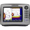
HDS-8 Base Mltfnc Fishfinder/Chartplotter w/ 83/200 K 34255
-
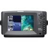
409000-1 858c HD Di Combo
-
FR8122 12.1 Inch 12KW 72 NM Radar with 4' Open Array Antenna
-
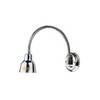
Ocean Chart Lamp, Medium
-
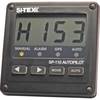
SP110 System w/ rfb & Remote Mech Drive - Sail 12"
-
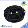
100ft RG6 (18AWG) 75OHM, Quad Shield, CL2 Coaxial Cable with F Type Connector - Black
-
WH10610 V-Grove Plug
-
CONNECTOR(PAIR) SS 863116
-
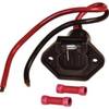
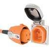
SmartPlug B30ASSY 30 Amp Marine Shore Power Inlet & Connector
-
P66-BL with Lowrance Blue Connector 50/200 D/S/T
-
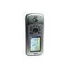
GPSMAP 76CSx - Marine, hiking GPS receiver - 2.6" color - 160 x 240