010-C0751-10 Bluechart G2 HAF451SNamibia to Knysna Sa Data
Model: 010-C0751-10 Brand: Garmin
Coverage of the southwestern coast of Africa from Cape Ponta-Grossa in Angola through Knysa, S. Including detailed coverage of Walvis Bay, Nam., as well as Port Nolloth, Hondelklipbaais, and Cape Town, S. Detailed coverage also includes the island of St. Helena, the Tristan da Cunha Group, and Gough Island. See your surroundings more clearly with BlueChart g2 data. With BlueChart g2, you'll get detailed marine cartography that provides convenient viewing of nautical content. BlueChart g2 allows you to see your vessel's precise, on-chart position in relation to naviads, coastal features, anchorages, obstructions, waterways, restricted areas and more. You will also have access to detailed mapping capabilities that include Safety Shading , Fishing Charts , smooth data transition between zoom levels, harmonious transition across chart borders, and reduction of chart discontinuities. « less
Product Specification
-
Universal Product Identifiers
Part Numbers: 010-C0751-10, 10804623, 35583GTIN: 00753759089719
Related Products
-
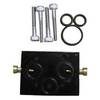
010-11201-00 Autopilot Unbalanced Valve Kit
-
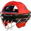
MD3-6S Life Raft 6 Person Soft Valise
-
2897.91 FBRS 2897 Battery Replacement Service - PLB-30
-
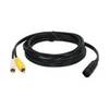
VC 1 - Video cable
-
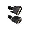
10 ft VGA cable 17 pin analog DVI - male - 15 pin HD D-Sub (HD-15) - male - PC
-
0.5meter SATA Serial ATA Cable (90 Degree - Right Angle)
-
Connector Oildyne Later Prestolite Pumps
-
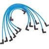
Marine Products Plug Wire Set, Mercruiser V-8, 9-28001
-
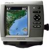
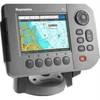
GPSMAP 526s - Marine Chartplotter - 5" color - 480 x 640
-
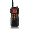
HX760S 6 Watt with Blue Tooth Headset
-
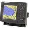
GlobalMap 5300C iGPS - Marine GPS receiver - 5" color - 480 x 480
-
A50 GPS / Chartplotter