010-C0728-10 Bluechart G2 HUS027RHawaiian Islands Mariana
Model: 010-C0728-10 Brand: Garmin
Coverage of the Pacific Ocean from the Hawaiian to Mariana Islands. Includes coverage of Guam, Midway, and Johnston Atoll. General coverage of Palmyra Atoll and the Marshall Islands also included. See your surroundings more clearly with BlueChart g2 data. With BlueChart g2, you'll get detailed marine cartography that provides convenient viewing of nautical content. BlueChart g2 allows you to see your vessel's precise, on-chart position in relation to naviads, coastal features, anchorages, obstructions, waterways, restricted areas and more. You will also have access to detailed mapping capabilities that include Safety Shading , Fishing Charts , smooth data transition between zoom levels, harmonious transition across chart borders, and reduction of chart discontinuities. « less
Product Specification
-
Universal Product Identifiers
Part Numbers: 010-C0728-10, 10469849, 35558, GAR010C072810GTIN: 00753759089290
Related Products
-
St6001 S1G Hydraulic Outboard sys E12122
-
SmartCast AS RSL - Wireless sonar link
-
Radar 5012 Package with GMR18 4KW Radome
-
Max Electronic Chart, Wide, South-West European Coasts, DVD, M-EM-M076
-
010-C0738-20 Bluechart G2 HXUS400SWalkers Cay to Exuma Sound
-
Pipe to Hose Adapter- Perko
-
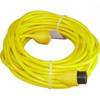
PH50 50 Foot Phone Cable Set (Yellow)
-
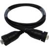
AA010080 - 2m Ethernet (rj45) Cable for NSX Systems
-
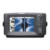
408890-1 898c HD Si Combo
-
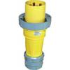
100HM1 120/250VAC - 100 Amp Male Plug
-
A5050Y50H Y Adapter - 2 50 Amp 125VAC Connectors -to- 1
-
CA28F-8 Rubber Coated Transducer 1kW No Plug